Quote of the Month:
“Nature gives to every time and season some beauties of its own." - Charles Dickens
“Nature gives to every time and season some beauties of its own." - Charles Dickens
| Location: | Eastern Washington |
| Roundtrip: | 6.2 miles |
| Elevation Gain: | 384 ft |
| Highest Point: | 2134 ft |
| GPS Coordinates: | N 47 51.960 W 119 04.950 |
| Visitor’s Information: |
Discover Pass Required |

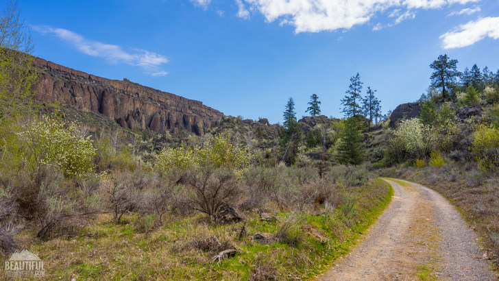
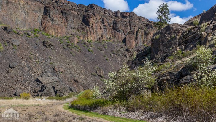
Northrup Canyon Trail is a well-known and popular trail near Steamboat Rock State Park. It’s a real paradise for those hikers who love not only hiking, but also wildlife watching. Here you will find beautiful wildflowers, breathtaking views, different representatives of flora and fauna as well as birds that love this place. It’s a great place to experience something new and interesting.

Northrup Canyon Trail is a 6.2-mile trail (roundtrip) that climbs into the canyon and represent the only native forest in Grant County.
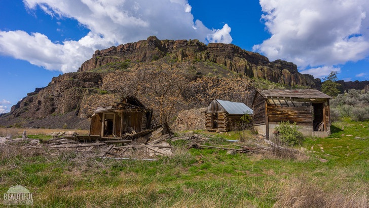
This area was settled by the Northrup family in the late 1800’s, but it has always been a shelter for people and animals. Hikers can still find an old house along the way and other artifacts of the long history of the area.

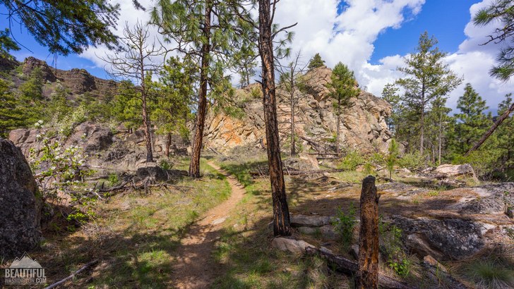
As we have already mentioned, the trail runs along the forest where hikers will find shelter and shade as well as they will be able to enjoy Douglas-fir, different kinds of pines, etc. This forest is home for a great number and variety of birds.

The most well-known are bald eagles that can be seen here from the middle of November to the beginning of April, these birds can be seen among the walls of Sheer Rock and on the trees in the forest. More than 200 of these fabulous and free-loving birds come here every year in winter. The best time to view the birds is the second part of the day (from 2 p.m. till dusk).While the path takes you to the canyon, look for woodpeckers, grouse, quail, swallows, sparrows and flickers. Enjoy their beautiful songs along the way. At the end of the trail, there is a treat for every hiker – a crystal and refreshing lake.
 Northrup Canyon Trail 1
Northrup Canyon Trail 1
Northrup Canyon Trail 1
 Northrup Canyon Trail 2
Northrup Canyon Trail 2
Northrup Canyon Trail 2
 Northrup Canyon Trail 3
Northrup Canyon Trail 3
Northrup Canyon Trail 3
 Northrup Canyon Trail 4
Northrup Canyon Trail 4
Northrup Canyon Trail 4
 Northrup Canyon Trail 5
Northrup Canyon Trail 5
Northrup Canyon Trail 5
 Northrup Canyon Trail 6
Northrup Canyon Trail 6
Northrup Canyon Trail 6
 Northrup Canyon Trail 7
Northrup Canyon Trail 7
Northrup Canyon Trail 7
 Northrup Canyon Trail 8
Northrup Canyon Trail 8
Northrup Canyon Trail 8
 Northrup Canyon Trail 9
Northrup Canyon Trail 9
Northrup Canyon Trail 9
 Northrup Canyon Trail 10
Northrup Canyon Trail 10
Northrup Canyon Trail 10
 Northrup Canyon Trail 11
Northrup Canyon Trail 11
Northrup Canyon Trail 11
 Northrup Canyon Trail 12
Northrup Canyon Trail 12
Northrup Canyon Trail 12
 Northrup Canyon Trail 13
Northrup Canyon Trail 13
Northrup Canyon Trail 13
 Northrup Canyon Trail 14
Northrup Canyon Trail 14
Northrup Canyon Trail 14
 Northrup Canyon Trail 15
Northrup Canyon Trail 15
Northrup Canyon Trail 15
 Northrup Canyon Trail 16
Northrup Canyon Trail 16
Northrup Canyon Trail 16
 Northrup Canyon Trail 17
Northrup Canyon Trail 17
Northrup Canyon Trail 17
 Northrup Canyon Trail 18
Northrup Canyon Trail 18
Northrup Canyon Trail 18
 Northrup Canyon Trail 19
Northrup Canyon Trail 19
Northrup Canyon Trail 19
 Northrup Canyon Trail 20
Northrup Canyon Trail 20
Northrup Canyon Trail 20
 Northrup Canyon Trail 21
Northrup Canyon Trail 21
Northrup Canyon Trail 21
 Northrup Canyon Trail 22
Northrup Canyon Trail 22
Northrup Canyon Trail 22
 Northrup Canyon Trail 23
Northrup Canyon Trail 23
Northrup Canyon Trail 23
 Northrup Canyon Trail 24
Northrup Canyon Trail 24
Northrup Canyon Trail 24
 Northrup Canyon Trail 25
Northrup Canyon Trail 25
Northrup Canyon Trail 25
 Northrup Canyon Trail 26
Northrup Canyon Trail 26
Northrup Canyon Trail 26
 Northrup Canyon Trail 27
Northrup Canyon Trail 27
Northrup Canyon Trail 27
 Northrup Canyon Trail 28
Northrup Canyon Trail 28
Northrup Canyon Trail 28
 Northrup Canyon Trail 29
Northrup Canyon Trail 29
Northrup Canyon Trail 29
 Northrup Canyon Trail 30
Northrup Canyon Trail 30
Northrup Canyon Trail 30
 Northrup Canyon Trail 31
Northrup Canyon Trail 31
Northrup Canyon Trail 31
 Northrup Canyon Trail 32
Northrup Canyon Trail 32
Northrup Canyon Trail 32
 Northrup Canyon Trail 33
Northrup Canyon Trail 33
Northrup Canyon Trail 33
 Northrup Canyon Trail 34
Northrup Canyon Trail 34
Northrup Canyon Trail 34
 Northrup Canyon Trail 35
Northrup Canyon Trail 35
Northrup Canyon Trail 35
 Northrup Canyon Trail 36
Northrup Canyon Trail 36
Northrup Canyon Trail 36
 Northrup Canyon Trail 37
Northrup Canyon Trail 37
Northrup Canyon Trail 37
 Northrup Canyon Trail 38
Northrup Canyon Trail 38
Northrup Canyon Trail 38
 Northrup Canyon Trail 39
Northrup Canyon Trail 39
Northrup Canyon Trail 39
 Northrup Canyon Trail 40
Northrup Canyon Trail 40
Northrup Canyon Trail 40
Take I-90 to exit 151 (SR-283) signed "Ephrata/Soap Lake." Drive through Ephrata and turn north at Soap Lake onto SR-17. Continue about 20 miles and turn right on SR-2. In 4.2 miles, you'll come to a Y junction. Stay straight to merge onto SR-155. At 18.8 miles from the Y junction, turn right onto the Northrup Canyon Natural Area. Continue 0.7 mile to the trailhead.
In order to get directions click on the map below:
Photo: Roman Khomlyak
Photo Editing: Alex Mandryko
Information: Marina Petrova
Leave your comment