Quote of the Month:
“Nature gives to every time and season some beauties of its own." - Charles Dickens
“Nature gives to every time and season some beauties of its own." - Charles Dickens
| Location: | Mount Rainier, Carbon River and Mowich Lake Area |
| Roundtrip of the trail: | 7.5 miles |
| Elevation Gain: | 1600 ft |
| Highest Point: | 6400 ft |
| GPS Coordinates: | 46°55'57.7"N 121°51'49.0"W |
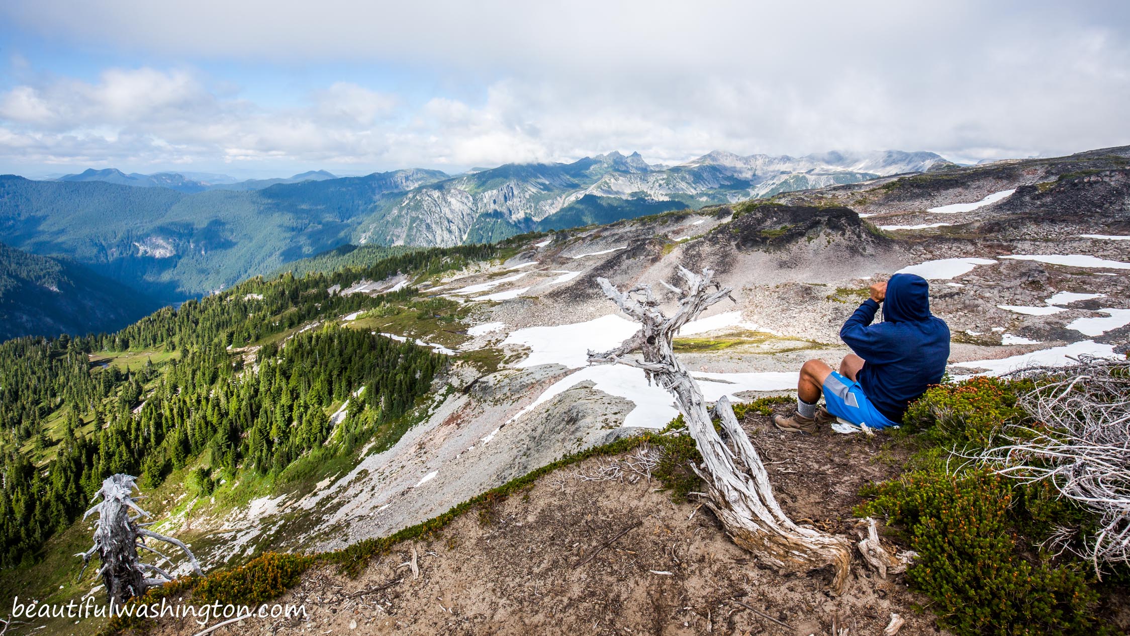
 Pictures below will take you on a virtual tour along the most beautiful alpine meadows. Enjoy scenic views and gorgeous nature!!!
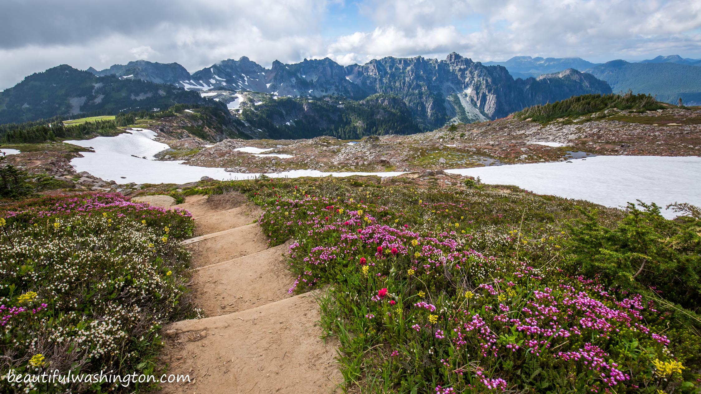
Spray Park is one of the most beautiful areas of Mount Rainier. This trail is popular because of its’ well-known alpine meadows full of flowers. Avalanche lilies and other flowers make Spray Park a perfect background for the astounding and close views of Mount Rainier.
The trip to Spray Park starts from Mowich Lake at an elevation of 3700 feet. Experts recommend starting your trip early, because this trail can be really crowded and you won’t be able to enjoy the whole and complete beauty of the alpine meadows and flowers. Spray Park Trail is the trail of perfect combinations: beautiful flowers grow near cold and white snow...the Creator has made this place unique and unusually beautiful. Take a look at the pictures below and enjoy this magic combination of flowers and snow! So mesmerizing!

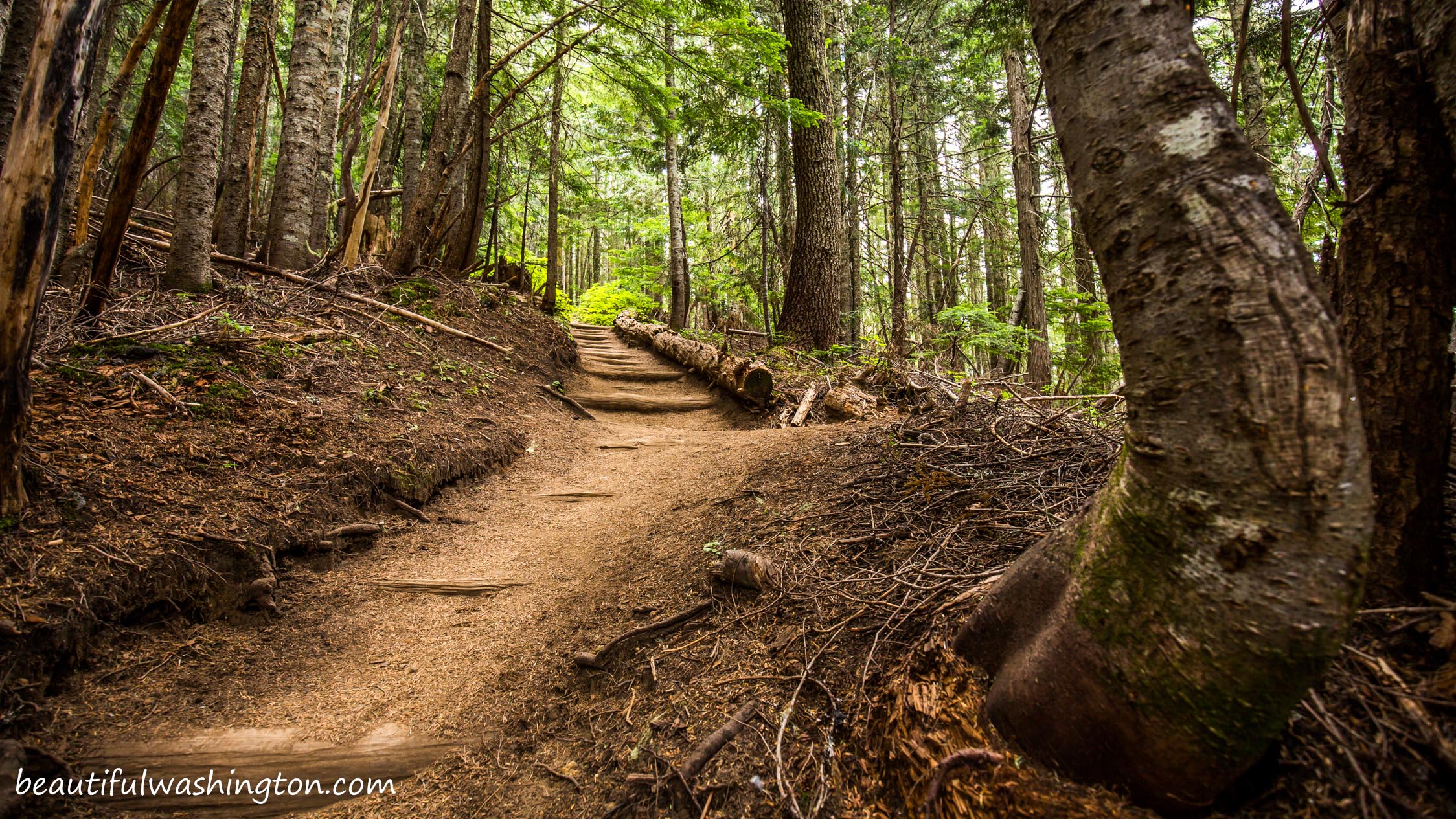
From Mowich Lake, in less than 0.1 mile, the trail comes to a junction with the Wonderland Trail. Be careful and don’t take the Wonderland Loop Trail. For the next 30 minutes the path takes you through old-growth forest.
After the first 30 minutes of the hike the trail starts climbing up, but climbing is not hard at all, especially with all the views you have. Don’t miss the opportunity to take a trail that will take you to majestic Spray Falls. A trip to Spray Falls is a must for anyone going to Spray Park.

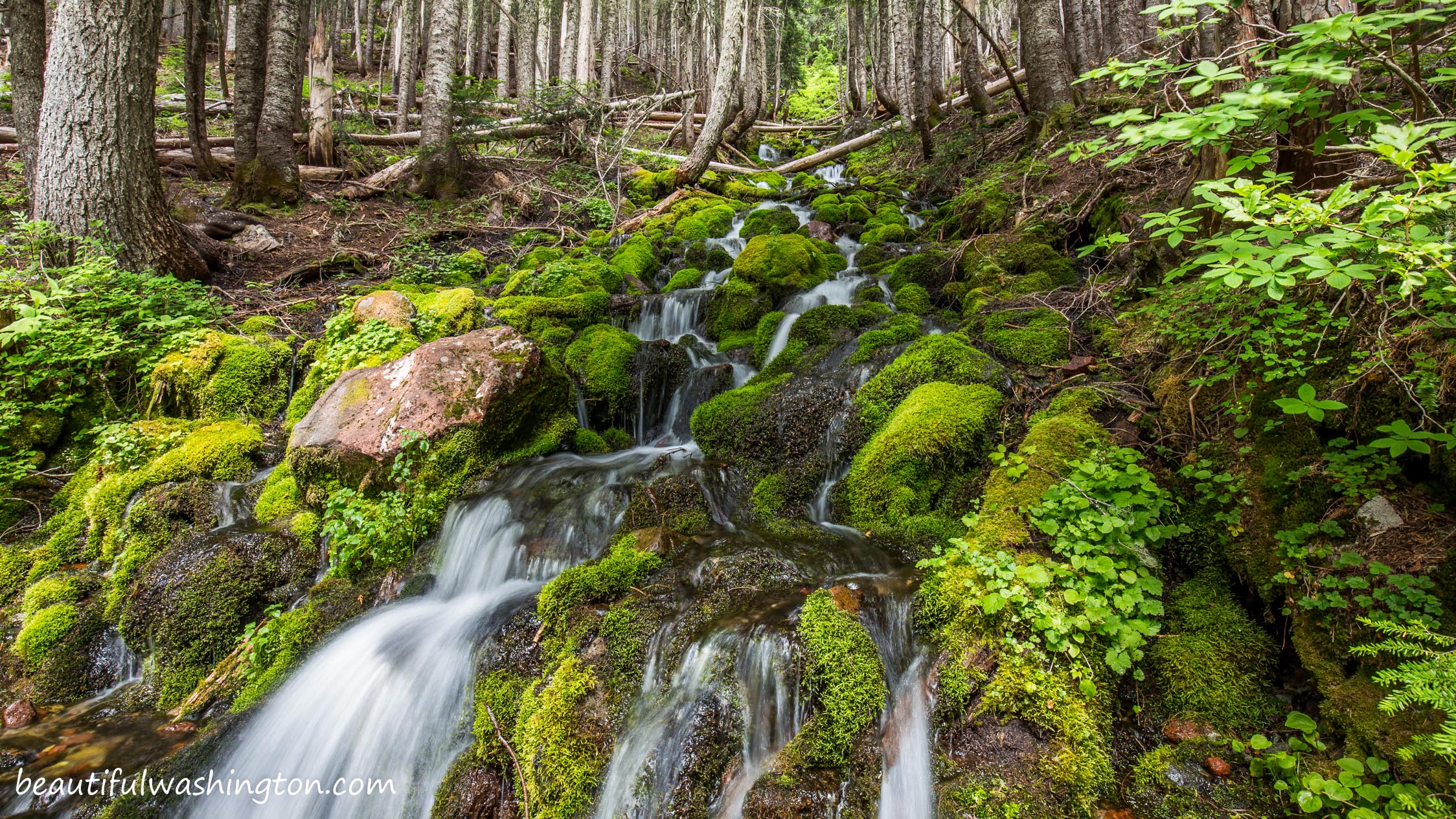
It’s not a secret that Spray Falls attract lots of visitors, don’t expect to enjoy the beauty of the falls in the quietness.
After visiting Spray Falls continue taking the trail that goes steeply up. After about 2.5 miles from the trailhead, the path will go across Grand Creek and the forest will open onto the most beautiful meadows with breathtaking views of Mount Rainier and Hessong Rock.
When you’re back at Mowich Lake, make sure you spend some time there and refresh yourself after a nice hike at Spray Park.
From Puyallup
Drive 13 miles east on State Route 410 to Buckley. Turn right onto SR 165 and continue through Carbonado. Just beyond the Carbon River Gorge bridge, turn right onto Mowich Lake Road. Follow the road to its end; the trailhead is at the far end of the Mowich Lake Campground.
 Spray Park 1
Spray Park 1
Spray Park 1
 Spray Park 2
Spray Park 2
Spray Park 2
 Spray Park 3
Spray Park 3
Spray Park 3
 Spray Park 4
Spray Park 4
Spray Park 4
 Spray Park 5
Spray Park 5
Spray Park 5
 Spray Park 6
Spray Park 6
Spray Park 6
 Spray Park 7
Spray Park 7
Spray Park 7
 Spray Park 8
Spray Park 8
Spray Park 8
 Spray Park 9
Spray Park 9
Spray Park 9
 Spray Park 10
Spray Park 10
Spray Park 10
 Spray Park 11
Spray Park 11
Spray Park 11
 Spray Park 12
Spray Park 12
Spray Park 12
 Spray Park 13
Spray Park 13
Spray Park 13
 Spray Park 14
Spray Park 14
Spray Park 14
 Spray Park 15
Spray Park 15
Spray Park 15
 Spray Park 16
Spray Park 16
Spray Park 16
 Spray Park 17
Spray Park 17
Spray Park 17
 Spray Park 18
Spray Park 18
Spray Park 18
 Spray Park 19
Spray Park 19
Spray Park 19
 Spray Park 21
Spray Park 21
Spray Park 21
 Spray Park 22
Spray Park 22
Spray Park 22
 Spray Park 23
Spray Park 23
Spray Park 23
 Spray Park 24
Spray Park 24
Spray Park 24
 Spray Park 25
Spray Park 25
Spray Park 25
 Spray Park 26
Spray Park 26
Spray Park 26
 Spray Park 27
Spray Park 27
Spray Park 27
 Spray Park 28
Spray Park 28
Spray Park 28
 Spray Park 29
Spray Park 29
Spray Park 29
 Spray Park 30
Spray Park 30
Spray Park 30
 Spray Park 31
Spray Park 31
Spray Park 31
 Spray Park 32
Spray Park 32
Spray Park 32
 Spray Park 33
Spray Park 33
Spray Park 33
 Spray Park 34
Spray Park 34
Spray Park 34
 Spray Park 35
Spray Park 35
Spray Park 35
 Spray Park 36
Spray Park 36
Spray Park 36
 Spray Park 37
Spray Park 37
Spray Park 37
 Spray Park 38
Spray Park 38
Spray Park 38
 Spray Park 39
Spray Park 39
Spray Park 39
 Spray Park 40
Spray Park 40
Spray Park 40
 Spray Park 41
Spray Park 41
Spray Park 41
 Spray Park 42
Spray Park 42
Spray Park 42
 Spray Park 43
Spray Park 43
Spray Park 43
 Spray Park 44
Spray Park 44
Spray Park 44
 Spray Park 45
Spray Park 45
Spray Park 45
 Spray Park 46
Spray Park 46
Spray Park 46
 Spray Park 47
Spray Park 47
Spray Park 47
 Spray Park 48
Spray Park 48
Spray Park 48
 Spray Park 49
Spray Park 49
Spray Park 49
 Spray Park 50
Spray Park 50
Spray Park 50
 Spray Park 51
Spray Park 51
Spray Park 51
 Spray Park 52
Spray Park 52
Spray Park 52
 Spray Park 53
Spray Park 53
Spray Park 53
 Spray Park 54
Spray Park 54
Spray Park 54
 Spray Park 55
Spray Park 55
Spray Park 55
 Spray Park 56
Spray Park 56
Spray Park 56
 Spray Park 57
Spray Park 57
Spray Park 57
 Spray Park 58
Spray Park 58
Spray Park 58
 Spray Park 59
Spray Park 59
Spray Park 59
 Spray Park 60
Spray Park 60
Spray Park 60
 Spray Park 61
Spray Park 61
Spray Park 61
 Spray Park 62
Spray Park 62
Spray Park 62
 Spray Park 63
Spray Park 63
Spray Park 63
 Spray Park 64
Spray Park 64
Spray Park 64
 Spray Park 65
Spray Park 65
Spray Park 65
 Spray Park 66
Spray Park 66
Spray Park 66
 Spray Park 67
Spray Park 67
Spray Park 67
 Spray Park 68
Spray Park 68
Spray Park 68
 Spray Park 69
Spray Park 69
Spray Park 69
 Spray Park 70
Spray Park 70
Spray Park 70
 Spray Park 71
Spray Park 71
Spray Park 71
 Spray Park 72
Spray Park 72
Spray Park 72
 Spray Park 73
Spray Park 73
Spray Park 73
 Spray Park 74
Spray Park 74
Spray Park 74
 Spray Park 75
Spray Park 75
Spray Park 75
 Spray Park 76
Spray Park 76
Spray Park 76
 Spray Park 77
Spray Park 77
Spray Park 77
 Spray Park 78
Spray Park 78
Spray Park 78
 Spray Park 79
Spray Park 79
Spray Park 79
 Spray Park 80
Spray Park 80
Spray Park 80
 Spray Park 81
Spray Park 81
Spray Park 81
 Spray Park 82
Spray Park 82
Spray Park 82
 Spray Park 83
Spray Park 83
Spray Park 83
 Spray Park 84
Spray Park 84
Spray Park 84
 Spray Park 85
Spray Park 85
Spray Park 85
 Spray Park 86
Spray Park 86
Spray Park 86
 Spray Park 87
Spray Park 87
Spray Park 87
 Spray Park 88
Spray Park 88
Spray Park 88
 Spray Park 89
Spray Park 89
Spray Park 89
 Spray Park 90
Spray Park 90
Spray Park 90
 Spray Park 91
Spray Park 91
Spray Park 91
 Spray Park 92
Spray Park 92
Spray Park 92
 Spray Park 93
Spray Park 93
Spray Park 93
 Spray Park 94
Spray Park 94
Spray Park 94
 Spray Park 95
Spray Park 95
Spray Park 95
 Spray Park 96
Spray Park 96
Spray Park 96
 Spray Park 97
Spray Park 97
Spray Park 97
 Spray Park 98
Spray Park 98
Spray Park 98
 Spray Park 99
Spray Park 99
Spray Park 99
 Spray Park 100
Spray Park 100
Spray Park 100
 Spray Park 101
Spray Park 101
Spray Park 101
 Spray Park 102
Spray Park 102
Spray Park 102
 Spray Park 103
Spray Park 103
Spray Park 103
 Spray Park 104
Spray Park 104
Spray Park 104
 Spray Park 105
Spray Park 105
Spray Park 105
 Spray Park 106
Spray Park 106
Spray Park 106
 Spray Park 107
Spray Park 107
Spray Park 107
 Spray Park 108
Spray Park 108
Spray Park 108
 Spray Park 109
Spray Park 109
Spray Park 109
 Spray Park 110
Spray Park 110
Spray Park 110
 Spray Park 111
Spray Park 111
Spray Park 111
 Spray Park 112
Spray Park 112
Spray Park 112
 Spray Park 113
Spray Park 113
Spray Park 113
 Spray Park 114
Spray Park 114
Spray Park 114
 Spray Park 115
Spray Park 115
Spray Park 115
 Spray Park 116
Spray Park 116
Spray Park 116
 Spray Park 117
Spray Park 117
Spray Park 117
 Spray Park 118
Spray Park 118
Spray Park 118
 Spray Park 119
Spray Park 119
Spray Park 119
 Spray Park 120
Spray Park 120
Spray Park 120
 Spray Park 121
Spray Park 121
Spray Park 121
 Spray Park 122
Spray Park 122
Spray Park 122
 Spray Park 123
Spray Park 123
Spray Park 123
 Spray Park 124
Spray Park 124
Spray Park 124
 Spray Park 125
Spray Park 125
Spray Park 125
 Spray Park 126
Spray Park 126
Spray Park 126
 Spray Park 127
Spray Park 127
Spray Park 127
 Spray Park 128
Spray Park 128
Spray Park 128
In order to get the directions click on the link below:
Photo: Roman Khomlyak
Photo Editing: Alex Mandryko
Information: Marina Petrova
Leave your comment