Quote of the Month:
“Nature gives to every time and season some beauties of its own." - Charles Dickens
“Nature gives to every time and season some beauties of its own." - Charles Dickens
| Location: | North Cascades Region, Mt. Baker Area |
| Roundtrip: | 1,7 miles |
| Difficulty: | Easy |
| Elevation Gain: | 300 feet |
| Highest Point: | 3984 feet |
| GPS Coordinates: | N 48 39.244 W 121 47.04 |
| Visitor’s Information: |
Northwest Forest Pass Required |

September, when it is still warm and the nature already starts to change into its magnificent autumn finery, is the perfect time for a family outing. And if you are looking for a short and easy hike with fascinating views, in which all the family members (including even small kids) will find a pleasure, the Blue Lake Trail is just the very place you need.
It’s amazing, but there are several lakes in Washington State with the name Blue Lake. The one we are talking in this article is located in North Cascades, Mount Baker Area.
The trail starts at the parking lot, which is the trailhead for 2 trails: the Blue Lake Trail # 604 and the Dock Butte Trail # 604.1. These two trails run together from the trailhead, splitting after 0,2 miles.

Before entering the forest the Blue Lake Trail runs through an old, very small clear-cut area. Walking through an old-growth forest, you may enjoy the beauty of various fir trees (you may find here pacific silver, Douglas and subalpine fir trees) and cedar trees, as well as the abundance of autumn colors of understorey. But be careful and watch your steps as at some places the roots of the trees are exposed.
After a 0,2 mile of such easy amble you will reach the trail junction with a sign. Turning left you will continue following the Blue Lake Trail. The second, Dock Butte Trail, leads to a place which used to be the site of the Forest Service fire lookout, and now is a spectacular vantage point providing the hikers with breathtaking views of Mount Baker.

Going further and coming closer to the lake the Blue Lake Trail will take you through some more young and old conifers, larches and mountain ash as well as through some small meadows. There are quite a lot of blueberry bushes, so if you are hiking this trail in summer, you may have a good time picking them, and in autumn you may enjoy their fall colors.
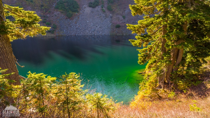
After about 0,7 miles from the trailhead you will be able to catch the first sight of the enchanting azure of Blue Lake waters. From here the trail starts descending, leading you closer to the northern side of the lake rocky shore. This part of the trail is covered with rocks and has a lot of exposed tree roots, that’s why be careful while going down (or climbing it when going back to the trailhead).

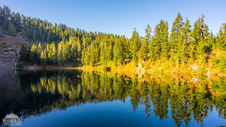
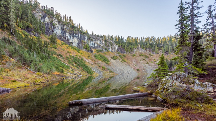
Here you can see Blue Lake, which is located at the elevation of almost 4000 feet, in its full beauty. From one side it is half-encircled by talus, like a huge rocky wall towering over the lake, and you may enjoy the lovely meadows covering the other side of the lake shores.

There are quite many social trails here, some of them are leading to the campsites, some of them showing the way to the water. You may use them to explore the area.
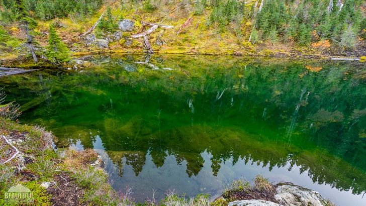
There is a big population of talus in Blue Lake. And the waters of the lake are so crystal-clear that you can see everything up to the lake’s bottom, including the fish, swimming there. Fishing is allowed here, but your catch will be limited up to five fish according to the fishing guidelines of the Washington Department of Fish and Wildlife. And, of course, you need a Washington State fishing license to fish here.
 Blue Lake Trail, Autumn 01
Blue Lake Trail, Autumn 01
Blue Lake Trail, Autumn 01
 Blue Lake Trail, Autumn 02
Blue Lake Trail, Autumn 02
Blue Lake Trail, Autumn 02
 Blue Lake Trail, Autumn 03
Blue Lake Trail, Autumn 03
Blue Lake Trail, Autumn 03
 Blue Lake Trail, Autumn 04
Blue Lake Trail, Autumn 04
Blue Lake Trail, Autumn 04
 Blue Lake Trail, Autumn 05
Blue Lake Trail, Autumn 05
Blue Lake Trail, Autumn 05
 Blue Lake Trail, Autumn 06
Blue Lake Trail, Autumn 06
Blue Lake Trail, Autumn 06
 Blue Lake Trail, Autumn 07
Blue Lake Trail, Autumn 07
Blue Lake Trail, Autumn 07
 Blue Lake Trail, Autumn 08
Blue Lake Trail, Autumn 08
Blue Lake Trail, Autumn 08
 Blue Lake Trail, Autumn 09
Blue Lake Trail, Autumn 09
Blue Lake Trail, Autumn 09
 Blue Lake Trail, Autumn 10
Blue Lake Trail, Autumn 10
Blue Lake Trail, Autumn 10
 Blue Lake Trail, Autumn 11
Blue Lake Trail, Autumn 11
Blue Lake Trail, Autumn 11
 Blue Lake Trail, Autumn 12
Blue Lake Trail, Autumn 12
Blue Lake Trail, Autumn 12
 Blue Lake Trail, Autumn 13
Blue Lake Trail, Autumn 13
Blue Lake Trail, Autumn 13
 Blue Lake Trail, Autumn 14
Blue Lake Trail, Autumn 14
Blue Lake Trail, Autumn 14
 Blue Lake Trail, Autumn 15
Blue Lake Trail, Autumn 15
Blue Lake Trail, Autumn 15
 Blue Lake Trail, Autumn 16
Blue Lake Trail, Autumn 16
Blue Lake Trail, Autumn 16
 Blue Lake Trail, Autumn 17
Blue Lake Trail, Autumn 17
Blue Lake Trail, Autumn 17
 Blue Lake Trail, Autumn 18
Blue Lake Trail, Autumn 18
Blue Lake Trail, Autumn 18
 Blue Lake Trail, Autumn 19
Blue Lake Trail, Autumn 19
Blue Lake Trail, Autumn 19
 Blue Lake Trail, Autumn 20
Blue Lake Trail, Autumn 20
Blue Lake Trail, Autumn 20
 Blue Lake Trail, Autumn 21
Blue Lake Trail, Autumn 21
Blue Lake Trail, Autumn 21
 Blue Lake Trail, Autumn 22
Blue Lake Trail, Autumn 22
Blue Lake Trail, Autumn 22
 Blue Lake Trail, Autumn 23
Blue Lake Trail, Autumn 23
Blue Lake Trail, Autumn 23
 Blue Lake Trail, Autumn 24
Blue Lake Trail, Autumn 24
Blue Lake Trail, Autumn 24
 Blue Lake Trail, Autumn 25
Blue Lake Trail, Autumn 25
Blue Lake Trail, Autumn 25
 Blue Lake Trail, Autumn 26
Blue Lake Trail, Autumn 26
Blue Lake Trail, Autumn 26
 Blue Lake Trail, Autumn 27
Blue Lake Trail, Autumn 27
Blue Lake Trail, Autumn 27
 Blue Lake Trail, Autumn 28
Blue Lake Trail, Autumn 28
Blue Lake Trail, Autumn 28
 Blue Lake Trail, Autumn 29
Blue Lake Trail, Autumn 29
Blue Lake Trail, Autumn 29
 Blue Lake Trail, Autumn 30
Blue Lake Trail, Autumn 30
Blue Lake Trail, Autumn 30
 Blue Lake Trail, Autumn 31
Blue Lake Trail, Autumn 31
Blue Lake Trail, Autumn 31
 Blue Lake Trail, Autumn 32
Blue Lake Trail, Autumn 32
Blue Lake Trail, Autumn 32
 Blue Lake Trail, Autumn 33
Blue Lake Trail, Autumn 33
Blue Lake Trail, Autumn 33
 Blue Lake Trail, Autumn 34
Blue Lake Trail, Autumn 34
Blue Lake Trail, Autumn 34
 Blue Lake Trail, Autumn 35
Blue Lake Trail, Autumn 35
Blue Lake Trail, Autumn 35
 Blue Lake Trail, Autumn 36
Blue Lake Trail, Autumn 36
Blue Lake Trail, Autumn 36
 Blue Lake Trail, Autumn 37
Blue Lake Trail, Autumn 37
Blue Lake Trail, Autumn 37
 Blue Lake Trail, Autumn 38
Blue Lake Trail, Autumn 38
Blue Lake Trail, Autumn 38
 Blue Lake Trail, Autumn 39
Blue Lake Trail, Autumn 39
Blue Lake Trail, Autumn 39
 Blue Lake Trail, Autumn 40
Blue Lake Trail, Autumn 40
Blue Lake Trail, Autumn 40
 Blue Lake Trail, Autumn 41
Blue Lake Trail, Autumn 41
Blue Lake Trail, Autumn 41
Drive I-5 until you reach exit 230 leading to Hwy 20 East. 22.5 miles drive (don’t forget to follow the signs for Hwy 20 East) will take you to a brown sign for Baker Lake Sno-Park. About 0.15 miles past the sign, take the left turn to the signed Baker Lake Road (Forest Road 11).
Drive approximately 12 miles along Baker Lake Road. Immediately after the Rocky Creek Bridge, turn left to the unsigned Forest Road 12 and proceed 3.5 miles more on Forest Road 12. After reaching a junction continue straight, following the sign for Blue Lake. After driving 3.2 miles, take the left turn at the sign for Blue Lake to Forest Road 1230. After driving the last 3.6 miles on Forest Road 1230 you will reach the trailhead and parking lot.
In order to get directions click on the map below:
Photo: Roman Khomlyak
Photo Editing: Juliana Voitsikhovska
Information: Svetlana Baranova
Leave your comment