Quote of the Month:
“Nature gives to every time and season some beauties of its own." - Charles Dickens
“Nature gives to every time and season some beauties of its own." - Charles Dickens
| Location: | South Cascades Region, East of Mount St. Helens |
| Roundtrip: | 2,4 miles |
| Difficulty: | Moderate |
| Elevation Gain: | 650 feet |
| Highest Point: | 4060 feet |
| GPS Coordinates: | N 46 16.461 W 122 06.251 |
| Visitor’s Information: |
Northwest Forest Pass Required |

Harmony Falls Trail is a short, only approximately 2,4 miles roundtrip, trail meandering through the eruption-affected territory to the very lakeshore of Spirit Lake. Actually this is the only trail which allows the hikers to get to the shoreline (legally) of Spirit Lake.
Its trailhead can be found at the Harmony Falls Viewpoint – one of several viewpoints and lookouts on the Forest Road #99, leading to another amazing vantage point – Windy Ridge Viewpoint.
The trail starts with quite a steep descend, running through an alley of young alder trees, which will become an ascent on your way back, and that’s where you may have quite a hard time if you are an inexperienced hiker.

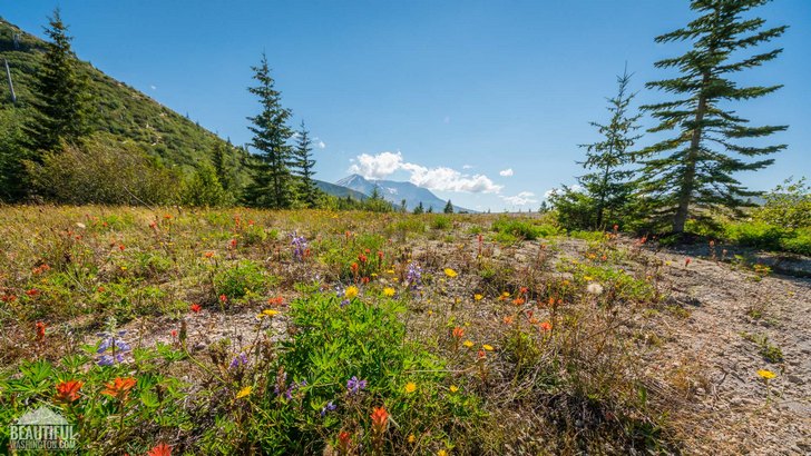
But going further, closer to the lake the trail becomes more leveled and is running through a landscape covered by young bushes and trees – a vivid demonstration of the mighty power of nature both of destruction (as this area was razed to the ground by Mount St. Helens’ eruption) and of revival, as it is just amazing how everything is step by step reverting to its original state. Enjoy the splendid views which are opening in front of you.
You will also be astonished by an abundance of wildflowers blooming around, delighting the eye and indulging the soul.

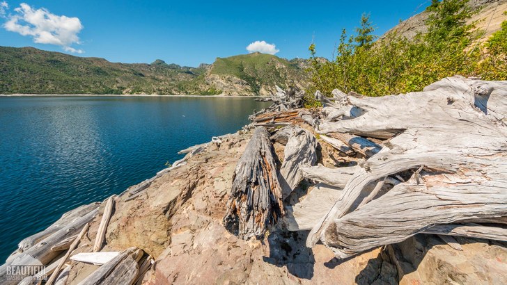
Soon you will pass what once used to be beautiful Harmony Falls, but after the eruption became just a tiny creek splashing over the rocks polished by water and glittering in the sun. Many years ago the landslide created by the volcanic eruption went down to the lake, thus creating a huge wave (about 800 feet high), which covered the opposite shore of Spirit Lake. Coming back to the lake its waters took the most part of the trees demolished by the eruption, thus covering almost all the surface of Spirit Lake with floating logs, which you can see even now, years later after the eryption.
This landslide also blocked the outlet of the lake which let to the raise of water level in the lake for more than 200 feet which submerged both the Harmony Falls and some lodges, which were located near the lake.

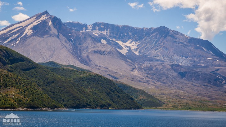
After an 1,2 mile stroll you will come to your final destination – the shoreline of the fascinating Spirit Lake. Take you time to walk along the shore, to soak yourself in breathtaking views of Mount St. Helens, towering behind the lake. But you should be careful with the logs, as they can be moved by the wind and be dangerous.
Please also remember, that swimming and fishing in Spirit Lake is forbidden.
 Harmony Falls Trail 1
Harmony Falls Trail 1
Harmony Falls Trail 1
 Harmony Falls Trail 2
Harmony Falls Trail 2
Harmony Falls Trail 2
 Harmony Falls Trail 3
Harmony Falls Trail 3
Harmony Falls Trail 3
 Harmony Falls Trail 4
Harmony Falls Trail 4
Harmony Falls Trail 4
 Harmony Falls Trail 5
Harmony Falls Trail 5
Harmony Falls Trail 5
 Harmony Falls Trail 6
Harmony Falls Trail 6
Harmony Falls Trail 6
 Harmony Falls Trail 7
Harmony Falls Trail 7
Harmony Falls Trail 7
 Harmony Falls Trail 8
Harmony Falls Trail 8
Harmony Falls Trail 8
 Harmony Falls Trail 9
Harmony Falls Trail 9
Harmony Falls Trail 9
 Harmony Falls Trail 10
Harmony Falls Trail 10
Harmony Falls Trail 10
 Harmony Falls Trail 11
Harmony Falls Trail 11
Harmony Falls Trail 11
 Harmony Falls Trail 12
Harmony Falls Trail 12
Harmony Falls Trail 12
 Harmony Falls Trail 13
Harmony Falls Trail 13
Harmony Falls Trail 13
 Harmony Falls Trail 14
Harmony Falls Trail 14
Harmony Falls Trail 14
 Harmony Falls Trail 15
Harmony Falls Trail 15
Harmony Falls Trail 15
 Harmony Falls Trail 16
Harmony Falls Trail 16
Harmony Falls Trail 16
 Harmony Falls Trail 17
Harmony Falls Trail 17
Harmony Falls Trail 17
 Harmony Falls Trail 18
Harmony Falls Trail 18
Harmony Falls Trail 18
 Harmony Falls Trail 19
Harmony Falls Trail 19
Harmony Falls Trail 19
 Harmony Falls Trail 20
Harmony Falls Trail 20
Harmony Falls Trail 20
 Harmony Falls Trail 21
Harmony Falls Trail 21
Harmony Falls Trail 21
 Harmony Falls Trail 22
Harmony Falls Trail 22
Harmony Falls Trail 22
Coming from Randle, you should follow the State Route 131 southward for approximately 2 miles until the place where it becomes Forest Road #25. Then drive for about 17.7 miles more and turn right onto FR #99. Continue further driving west on FR 99 for about 13 miles to the very trailhead.
In order to get directions click on the map below:
Photo: Roman Khomlyak
Photo Editing: Juliana Voitsikhovska
Information: Svetlana Baranova
Leave your comment