Quote of the Month:
“Nature gives to every time and season some beauties of its own." - Charles Dickens
“Nature gives to every time and season some beauties of its own." - Charles Dickens
The United States of America are relatively rich in volcanoes, being a home for 169 of them. The United States Geological Survey within their Volcano Hazard Program made a list of volcanoes, presenting a “Very High Threat”. This list consists out of 18 volcanoes all over the US, and among them there are the names of 4 Washington State volcanoes: Glacier Peak, Mount Baker, Mount Rainier and Mount St. Helens. One of them – Mount Rainier – is also included in the list of Decade Volcanoes, created by the International Association of Volcanology and Chemistry of the Earth’s Interior (this list contains 16 the most potentially dangerous and destructive volcanoes all over the world).
There are 5 major active volcanoes in the State of Washington, which until the eruption of Mount St. Helens in 1980 were also 5 highest mountains in the state. Four of them were mentioned above and the fifth one is Mount Adams. The beauty of these mountains is unparalleled, and the recreation possibilities which can be found at the areas surrounding these mountains encourage millions of tourists and local residents to visit these spectacular giants of Washington State. But hardly half of the visitors fully understand what threats are concealed behind this incredible beauty.

No one will deny the fact that Mount Rainier is one of the most beautiful and magnificent peaks in the whole world. The highest mountain in Washington State and number three mountain in the list of American ultra-prominent mountain peaks, this amazing natural giant (which has 14, 410 feet at its highest point) on a day with clear sunny weather can be well seen from such remote places as Portland, Oregon State or even from Vancouver Island, Canada. Mount Rainier in the sunlight looks powerful and mysterious.
Being a central natural feature of Mount Rainier National Park, it is well-known for its unique plant and animal life. Pristine forests covering its hills and ridges, fascinating alpine meadows, hundreds of mountain rivers, streams and of course the enchanting alpine lakes, numerous campgrounds and great skiing possibilities, offered by Mount Rainier, attract millions of tourists every year. Because of such a variety of entertainment options the tourist flow doesn’t subside at any season.
But hardly even half of all the tourists and visitors know and understand with what danger this highest mountain of the Cascades Range is fraught. Because, on top of everything else, Mt. Rainier is one of the largest active volcanoes in the world. And in reality its beauty and enchantment are deceptive, as no one can predict when this sleeping volcano will wake up.
The present-day Mount Rainier has 26 principal glaciers; each of them has its own name. With all the snow and ice (amounting to 36 sq mi) they create a huge glacier system of the mountain. Volcano summit has two large overlapping craters with the diameters of more than a thousand feet. Being located on a subduction zone, the volcano permanently experiences geothermal activity. Due to this geothermal heat the crater lips are remaining free of snow. It also created a huge network of caves in the glaciers filling the craters.

Mount Rainier is the highest composite volcano (or stratovolcano) of the Cascade Volcanic Ark. The scientists claim that the eruptions of the ancient, primordial Rainier volcano started more than 800,000 years ago, but that volcano cone was almost completely destroyed by one of the eruptions and a new cone (the one that we can see today) was created by lava and debris flows as well as by some pyroclastic ejecta about 500,000 years ago, and since then it has been showing volcanic activity.
Geologists assume that Mount Rainier used to be about 1,500 ft higher, but about 5,000 years ago an eruption and a huge debris avalanche (which led to Osceola Mudflow) removed the upper part of its cone.
Since then Mount Rainier had numerous eruptions, some of which were quiet, lava-producing, and some – explosive. The latest eruptions were recorded in the second part of the 19th century. And though the volcano keeps quiet since then, the scientists started a more detailed studying of its history and possibility of imminent eruption after the devastating eruption of Mount St. Helens in 1980.
When people talk about the most menacing volcanoes, they, first of all, mention Yellowstone or Mount Tambora, which in 1815 took more than 50 000 lives. However, geologists today are more concerned about other mountain peak, the eruption of which could cause the death of tens of thousands of Americans. "A Ticking Bomb" is the name which recently stuck to Mount Rainier, located just 54 miles from Seattle. According to volcanologists, even its minor activity could result in serious disaster, not to mention the full-scale eruption of the same power as the latest eruption of Mount St. Helens.

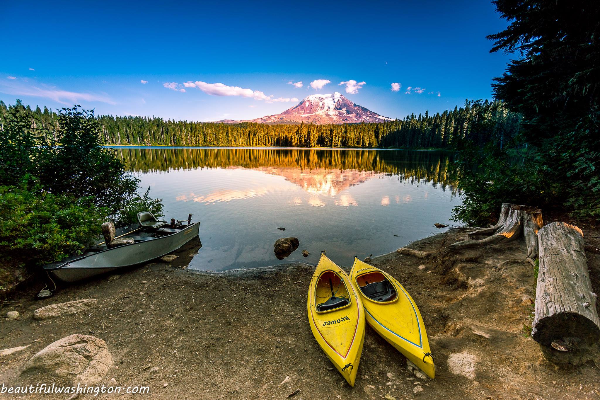
While Mount Rainier is the highest mountain in the State of Washington, Mount Adams ranks second in the list of Washington's highest mountains (with the height of 12281 ft) and is, as well, the largest (by volume) volcano in Washington State (with about 70 mi3 of eruptive material) and the second largest within the Cascade Range, giving way only to Mount Shasta, located in California State.
It is situated in the center of Mount Adams volcanic field, occupying the area of approximately 500 sq.mi., and comprising a little bit more than a hundred of other volcanoes, mainly basaltic.
The last eruption of Mt. Adams volcano happened about 1,000 years ago, but geologists say that the next eruption may happen any time. And in 1921 a huge rock avalanche happened on Mt. Adams, which was probably started by a steam explosion from one of the vents on the mountain, as the steam vents at the slide area were active for three more years.
Though being so highly ranked, Mount Adams is considered the least popular and visited among the five volcanoes we are describing in this article.
Located in Skamania and Yakima Counties, Mt. Adams is only a little more than 30 miles eastwards of Mt. St. Helens. About 60% of the mountain (its western part, as well as the upper part of the summit) constitute the Mount Adams Wilderness, while its eastern slopes belong to Yakama Nation Reservation.
The upper part of Mount Adams is covered with the glaciers. There are actually 12 named glaciers, covering the area of about 9 sq.mi. The territory of the mountain, located below the 6,500 feet height, is mostly covered by a beautiful dense forest.
Mount Adams Wilderness, as well as Mount Adams Recreation Area (located at the south-eastern part of the mountain and being a part of Yakama Nation Reservation) offers the visitors numerous hiking and climbing possibilities. Miles of trails, winding through the slopes of Mount Adams, will amaze you by stunning views of the surrounding landscapes. Lovely meadows, gorgeous mountain peaks, magnificent forest and abundance of wildflowers during spring and summer periods – Mount Adams has a lot in store to provide you with unforgettable memories.

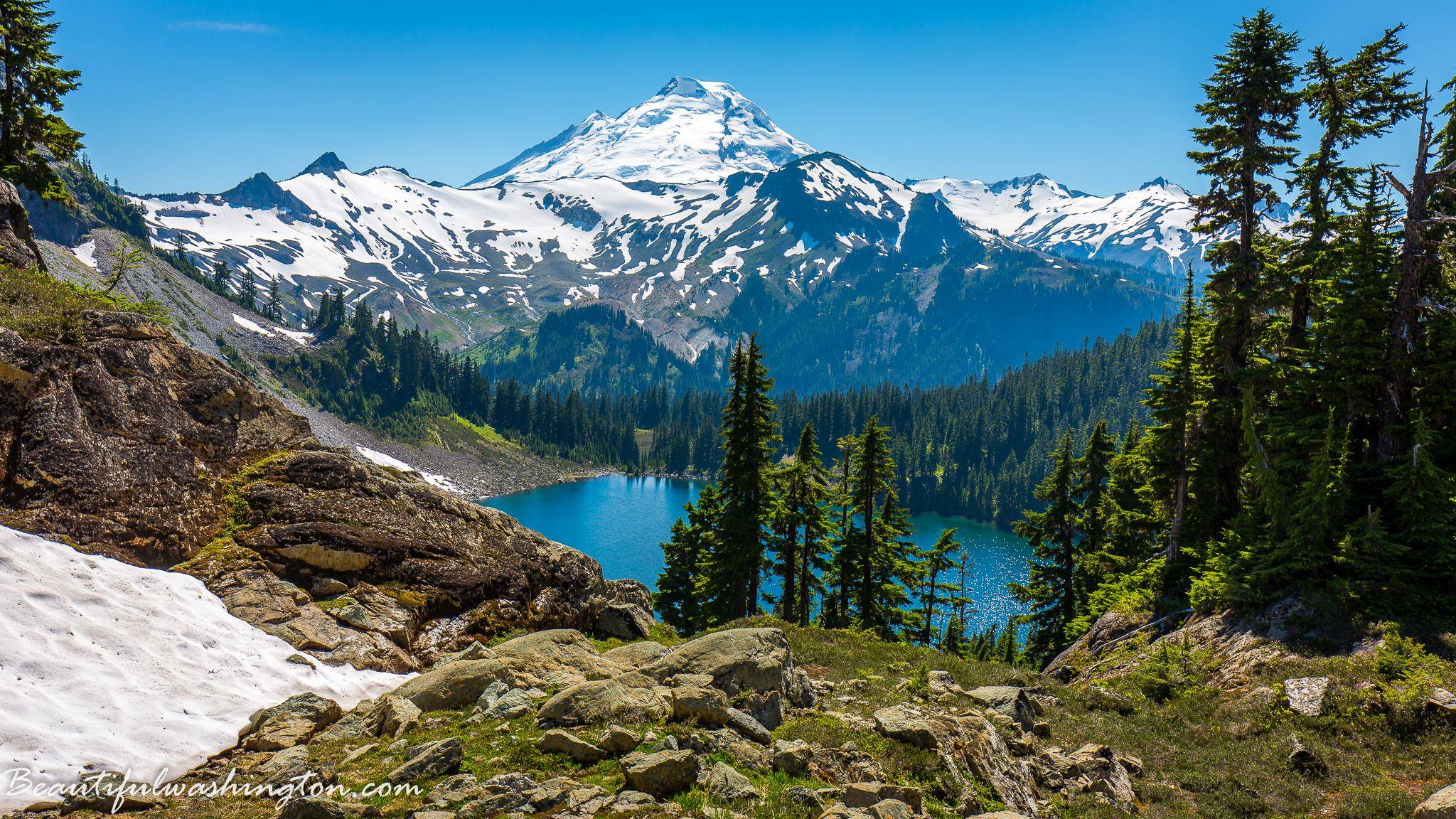
Mount Baker is the main jewel in the crown of the North Cascades. Situated a little more than 30 miles eastward of Bellingham, in Whatcom County, this active volcano is a clearly visible landmark from the most part of the northern region of Puget Sound.
Its age is more than 350,000 years and it originates from the age of the Pleistocene. Mount Baker Volcano relates to stratovolcanos, which means that it has a layered structure, a conical shape and is composed from a multitude of layers of hardened lava, tephra, and volcanic ash. Erupted by it lava was very viscous and dense, so it solidified before it could spread far.
Mount Baker is a part of the Cascade Range and it is the northernmost active volcano of Washington State, located not far from the border with Canada. The absolute height of the volcano above the sea level is 10,786 feet, and its height relative to the earth’s nearest point (or its prominence) is 8,860 feet, thus making Mount Baker the third highest mountain in the State of Washington.
In modern history the volcanic activity has been observed here since 1495, within which time there were 20 catastrophic and about 50 large eruptions. The last major eruption was recorded in 1860, but this volcano is sufficiently active up to the present day. A splash of new fumarole activity at Mt. Baker began in 1975. New clusters and cracks started appearing on Sherman crater, with large discharge of steam from them. Shortly after the beginning of this activity, the increase of acidity and the sulfur content was recorded in the waters of Boulder Creek valley. Most thermal activity at the volcano in addition to the Sherman Crater is observed at Dorr field, located on the northern side of the mountain cone.
Mount Baker has always attracted the interest of people; the first ascent of it, after several unsuccessful attempts, was done in 1868 by Edmund Coleman and his companions: John Tennant, Straton Thomas and David Ogilvy. And nowadays Mount Baker and the area surrounding it are visited by many people. Its glacier-covered slopes are extremely popular among hikers, climbers, skiers and snowshoers.
Mount Baker Ski Area is one of the favorite places for the tourists and locals during the winter season and numerous trails meandering through the Mount Baker area, taking the hikers through the most beautiful places of this region, draw the attention of nature lovers during spring-summer-autumn period.
Glacier Peak ranks number four in the list of Washington State highest mountains, and is one of the largest state’s active volcanoes. Nevertheless, this stratovulcano is the least popular, probably because of its location, as Glacier Peak is quite isolated and the most remote volcano in the Cascade Range. It is located in Snohomish County, approximately seventy miles northeastwards of Seattle.
The location of Glacier Peak is a subduction zone of two tectonic plates, the northern part of Juan de Fuca Plate that goes down under the North American Plate. Glacier Peak height above the sea level is 10,541 feet, and its prominence is 7,519 feet. The diameter of the volcano crater reaches up to 4,35 miles. Glacier Peak Volcano is the highest point of the same-name mountain range volcanic belt of the Cascade Mountains, which is more than 40 miles in length. It is mostly surrounded by woodland, and the top of it is covered with very old glaciers.
The USGS is continuously monitoring the seismic activity of Glacier Peak Volcano. At the moment it is poorly active, as evidenced by only a small amount of hot springs on its slopes. Although some time ago, together with the volcano Mount St. Helens it carried the most destructive power in the State of Washington, under the influence of their eruptions rivers have repeatedly changed their riverbeds. The highest activity of this volcano was during Holocene historical period. The last eruption was around 17-18 century.
Unfortunately Glacier Peak is insufficiently active in touristic area. Classic hiking/climbing routes take 2-3 days, the shortest route can be found in the area of the White Chuck River – its length is approximately 5 miles. The best time for hiking is from May till August. Since Glacier Peak is covered with snow all year round and has a lot of gentle slopes, it is of interest to fans of schussing.

There is probably no person in whole Washington State, who has never heard of Mount Saint Helens and its horrible devastating eruption in May of 1980, which took lives of fifty-seven people and crippled the economy greatly.
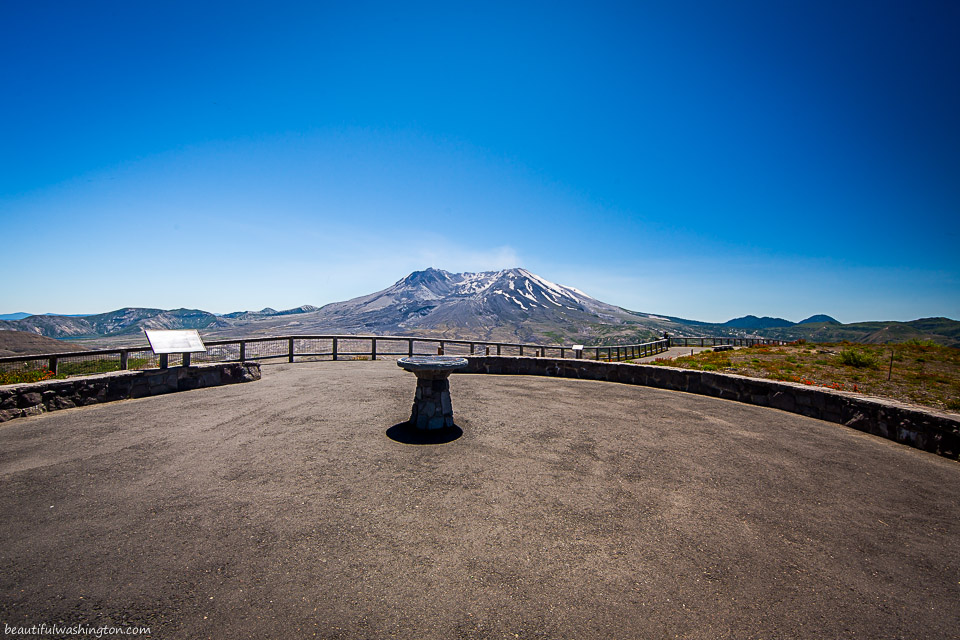
Mount St. Helens used to be the fifth highest mountain of Washington State, located in Skamania County, but the eruption and huge avalanche reduced its height to 8,365 feet, thus taking it down in the rank to number fifty-two. Now the volcano, which used to have conical shape, has a crater with the shape of a horseshoe, which is filled partially with lava and is covered by a glacier.
The episodic eruptions kept happening since 1980 till 1986, during which a new lava dome was created. Then after some time of being quiet, the scientists recorded a new activity period within the years 1989 – 2001. During this period scientists made the records of several (at least six) ash-producing and gas explosions on Mount St. Helens. The last period of the volcano activity was in 2004-2008.
In 1982 Ronald Reagan decided to set aside Mount St. Helens and the territories surrounding it for research and educational purposes. Thus on August 27, 1982 Mount St. Helens National Volcanic Monument was established, occupying the territory of 110,000 acres in 3 Washington counties (Skamania, Lewis and Cowlitz).
Nowadays this National Volcanic Monument accepts more than 500,000 visitors annually and has a wide range of recreational and interpretational options. At visitors’ disposal is Mount St. Helens Visitor Center at Silver Lake, Johnston Ridge Observatory, Science and Learning Center at Coldwater, viewing points at Bear Meadows and Windy Ridge as well as numerous hiking trails and various climbing possibilities.
Mount St. Helens National Volcanic Monuments is administered and operated by the U.S. Forest Service, but there are debates going on to give Mount St. Helens the status of National Park.
 Mount Adams 3
Mount Adams 3
Mount Adams 3
 Mount Adams 4
Mount Adams 4
Mount Adams 4
 Mount Adams 5
Mount Adams 5
Mount Adams 5
 Mount Adams 6
Mount Adams 6
Mount Adams 6
 Mount Adams 7
Mount Adams 7
Mount Adams 7
 Mount Adams 1
Mount Adams 1
Mount Adams 1
 Mount Adams 2
Mount Adams 2
Mount Adams 2
 Mount Baker 2
Mount Baker 2
Mount Baker 2
 Mount Baker 1
Mount Baker 1
Mount Baker 1
 Mount Baker 3
Mount Baker 3
Mount Baker 3
 Mount Rainier 1
Mount Rainier 1
Mount Rainier 1
 Mount Rainier 3
Mount Rainier 3
Mount Rainier 3
 Mount Rainier 2
Mount Rainier 2
Mount Rainier 2
 Mount St. Helens 3
Mount St. Helens 3
Mount St. Helens 3
 Mount St. Helens 5
Mount St. Helens 5
Mount St. Helens 5
 Mount St. Helens 4
Mount St. Helens 4
Mount St. Helens 4
 Mount St. Helens 6
Mount St. Helens 6
Mount St. Helens 6
 Mount St. Helens 1
Mount St. Helens 1
Mount St. Helens 1
 Mount St. Helens 2
Mount St. Helens 2
Mount St. Helens 2
Photo: Roman Khomlyak
Information: Svetlana Baranova
Leave your comment