Quote of the Month:
“Nature gives to every time and season some beauties of its own." - Charles Dickens
“Nature gives to every time and season some beauties of its own." - Charles Dickens
| Location: | King County, Issaquah |
| Address: | 18201, Southeast Cougar Mountain Drive, Issaquah, WA 98027 phone: +1 206-296-8687 |
| Hours: | 8.00 a.m. - dusk |
| GPS Coordinates: | N 47 31 42.2 W 122 05 59.7 |
| Visitor’s Information: |
Discover Pass Not Required |

Cougar Mountain Regional Wildland Park is one of the best recreation places in King County, full of history and various natural wonders.
One may call it an “urban oasis” as it’s a huge park (3,115 acres of protected area) full of wildlife, located just several minutes drive from such Eastside cities as Bellevue, Newcastle and Issaquah.
Despite the fact that it is so close to civilization, this incredible park takes you deep into nature and away from the bustle of the city just in a minutes’ walk.

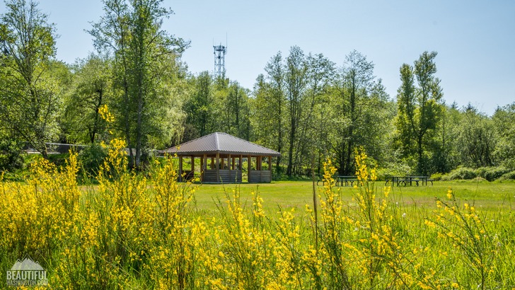
The Cougar Mountain Park has a diverse landscape. Its western part is rather mountainous, and its central and eastern parts are basically wetlands and marshes. Hiking there you will find second growth forests, cliffs and caves, streams and waterfalls (4 waterfalls could be found there). Besides the hiking trails the Cougar Mountain Regional Wildland Park has several lookouts providing you with really breathtaking views of Lake Sammamish, the Cascades and Bellevue.

The park is a perfect representative of history, nature and culture of the King County.
It used to be a home for Native Americans who came there for hunting and gathering berries and plants. Then later, when the area started to be settled, a lot of miners and loggers had been working there. As a result, there are a lot of mining caves and coal mine shafts left at the territory of the park, which you can explore during the hike.
During the Cold War there were two Nike missile installations were positioned on the current territory of Cougar Mountain Regional Wildland Park (near the Sky Country Trailhead). They were intended to protect the Puget Sound area from the possible air attacks. Later these missile sites were discarded. There are some information signs making the history of the place available for those who are interested in it.

As Cougar Mountain Regional Wildland Park is a county park, it doesn’t need any entrance fee or a Discovery Pass. The parking is also free.
It’s a great place not only for the hikers but also for family outings as there is a huge amount of trails of different complexity.
The park comprises 38 miles of hiking trails and 12 miles of equestrian trails. Its dog friendly, but no bikes are permitted on any of the trails.

There are four main trailheads in the park: Jim Whittaker Wilderness Peak Trailhead (previously called the Wilderness Creek Trailhead), Anti-Aircraft Peak Trailhead, Sky country Trailhead and Red Town Trailhead.
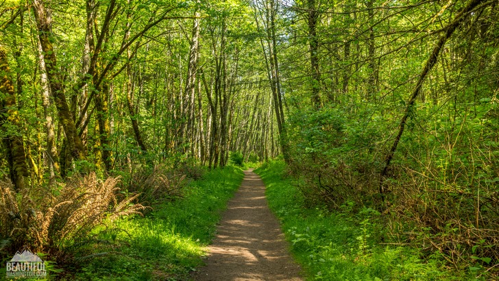
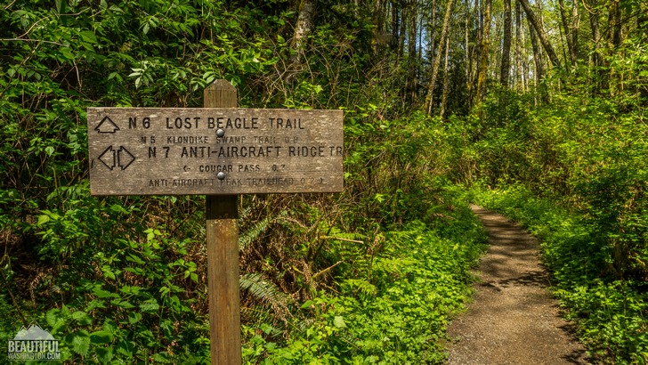
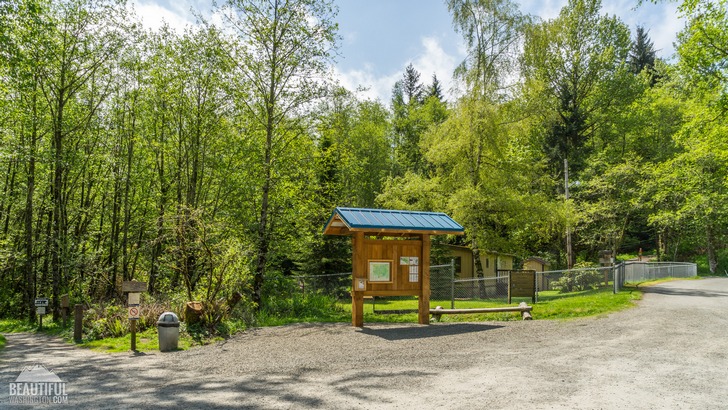
At each trailhead there is a stand with a big map of the park posted on it and some small printed trail maps which you can take along not to get lost. All the trails are good marked, with a lot of signs showing where you are and distance to your destination.
All the trails are also clean and really well maintained.
 Cougar Mountain Regional Wildland Park 01
Cougar Mountain Regional Wildland Park 01
Cougar Mountain Regional Wildland Park 01
 Cougar Mountain Regional Wildland Park 02
Cougar Mountain Regional Wildland Park 02
Cougar Mountain Regional Wildland Park 02
 Cougar Mountain Regional Wildland Park 03
Cougar Mountain Regional Wildland Park 03
Cougar Mountain Regional Wildland Park 03
 Cougar Mountain Regional Wildland Park 04
Cougar Mountain Regional Wildland Park 04
Cougar Mountain Regional Wildland Park 04
 Cougar Mountain Regional Wildland Park 05
Cougar Mountain Regional Wildland Park 05
Cougar Mountain Regional Wildland Park 05
 Cougar Mountain Regional Wildland Park 06
Cougar Mountain Regional Wildland Park 06
Cougar Mountain Regional Wildland Park 06
 Cougar Mountain Regional Wildland Park 07
Cougar Mountain Regional Wildland Park 07
Cougar Mountain Regional Wildland Park 07
 Cougar Mountain Regional Wildland Park 08
Cougar Mountain Regional Wildland Park 08
Cougar Mountain Regional Wildland Park 08
 Cougar Mountain Regional Wildland Park 09
Cougar Mountain Regional Wildland Park 09
Cougar Mountain Regional Wildland Park 09
 Cougar Mountain Regional Wildland Park 10
Cougar Mountain Regional Wildland Park 10
Cougar Mountain Regional Wildland Park 10
 Cougar Mountain Regional Wildland Park 11
Cougar Mountain Regional Wildland Park 11
Cougar Mountain Regional Wildland Park 11
 Cougar Mountain Regional Wildland Park 12
Cougar Mountain Regional Wildland Park 12
Cougar Mountain Regional Wildland Park 12
 Cougar Mountain Regional Wildland Park 13
Cougar Mountain Regional Wildland Park 13
Cougar Mountain Regional Wildland Park 13
 Cougar Mountain Regional Wildland Park 14
Cougar Mountain Regional Wildland Park 14
Cougar Mountain Regional Wildland Park 14
 Cougar Mountain Regional Wildland Park 15
Cougar Mountain Regional Wildland Park 15
Cougar Mountain Regional Wildland Park 15
 Cougar Mountain Regional Wildland Park 16
Cougar Mountain Regional Wildland Park 16
Cougar Mountain Regional Wildland Park 16
 Cougar Mountain Regional Wildland Park 17
Cougar Mountain Regional Wildland Park 17
Cougar Mountain Regional Wildland Park 17
 Cougar Mountain Regional Wildland Park 18
Cougar Mountain Regional Wildland Park 18
Cougar Mountain Regional Wildland Park 18
 Cougar Mountain Regional Wildland Park 19
Cougar Mountain Regional Wildland Park 19
Cougar Mountain Regional Wildland Park 19
 Cougar Mountain Regional Wildland Park 20
Cougar Mountain Regional Wildland Park 20
Cougar Mountain Regional Wildland Park 20
 Cougar Mountain Regional Wildland Park 21
Cougar Mountain Regional Wildland Park 21
Cougar Mountain Regional Wildland Park 21
 Cougar Mountain Regional Wildland Park 22
Cougar Mountain Regional Wildland Park 22
Cougar Mountain Regional Wildland Park 22
 Cougar Mountain Regional Wildland Park 23
Cougar Mountain Regional Wildland Park 23
Cougar Mountain Regional Wildland Park 23
 Cougar Mountain Regional Wildland Park 24
Cougar Mountain Regional Wildland Park 24
Cougar Mountain Regional Wildland Park 24
 Cougar Mountain Regional Wildland Park 25
Cougar Mountain Regional Wildland Park 25
Cougar Mountain Regional Wildland Park 25
 Cougar Mountain Regional Wildland Park 26
Cougar Mountain Regional Wildland Park 26
Cougar Mountain Regional Wildland Park 26
 Cougar Mountain Regional Wildland Park 27
Cougar Mountain Regional Wildland Park 27
Cougar Mountain Regional Wildland Park 27
 Cougar Mountain Regional Wildland Park 28
Cougar Mountain Regional Wildland Park 28
Cougar Mountain Regional Wildland Park 28
 Cougar Mountain Regional Wildland Park 29
Cougar Mountain Regional Wildland Park 29
Cougar Mountain Regional Wildland Park 29
 Cougar Mountain Regional Wildland Park 30
Cougar Mountain Regional Wildland Park 30
Cougar Mountain Regional Wildland Park 30
 Cougar Mountain Regional Wildland Park 31
Cougar Mountain Regional Wildland Park 31
Cougar Mountain Regional Wildland Park 31
 Cougar Mountain Regional Wildland Park 32
Cougar Mountain Regional Wildland Park 32
Cougar Mountain Regional Wildland Park 32
 Cougar Mountain Regional Wildland Park 33
Cougar Mountain Regional Wildland Park 33
Cougar Mountain Regional Wildland Park 33
 Cougar Mountain Regional Wildland Park 34
Cougar Mountain Regional Wildland Park 34
Cougar Mountain Regional Wildland Park 34
 Cougar Mountain Regional Wildland Park 35
Cougar Mountain Regional Wildland Park 35
Cougar Mountain Regional Wildland Park 35
Jim Whittaker Wilderness Peak Trailhead: you should take Exit 15 from I-90 and then drive south on HWY 900 (17th Ave NW, then Renton-Issaquah Road SE) for about 3.3 miles.
Red Town Trailhead: you should take Exit 13 from I-90, then go south on Lakemont Blvd SE for 3.1 miles. The entrance to the Red Town Trailhead should be on the left side of the road.
Sky Country Trailhead: you should take Exit 13 from I-90, then go south on Lakemont Blvd SE for 2.5 miles. Then turn left on SE Cougar Mountain Way and then turn right on 166th Way SE. Drive along 166th up to its end (about 0.7 miles). On the right will be the Sky Country Trailhead.
Anti-Aircraft Peak Trailhead: you should take Exit 13 from I-90, then go south on Lakemont Blvd SE for 2.5 miles. Then turn left on SE Cougar Mountain Way. Then you should follow the double yellow line (the road will turn left and will be named 168th Pl SE, then it will turn right and will become SE 60th St.). Turn off 60th to the dead end road, which is SE Cougar Mountain Dr.
In order to get directions click on the map below:
Photo: Roman Khomlyak
Photo Editing: Juliana Voitsikhovska
Information: Svetlana Baranova
Leave your comment